Courses
Summer 2022 - Geomatics Engineering (CME 494)
- Graduate: 4 Units
- Instructor: Dr. Farid Peiravian
Geomatics Engineering is a new and fast-growing branch of engineering. It is the technology that defines spatial relationships of artificial and natural objects of this world in its true three-dimensional form. As a branch of applied science and professional discipline, Geomatics Engineering involves an integrated approach to the measurement, analysis, management, and display of geographic and other spatial data. Geomatics Engineering has many applications in Civil Engineering disciplines. Its professionals are highly in demand, with high pay rates.
Geomatics Engineering encompasses many modern cutting-edge technologies, including:
- Surveying (a part of the FE exam)
- Remote Sensing (RS)
- Cartography (digital mapping)
- Global Position System (GPS)
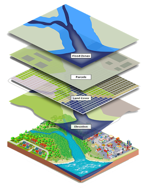
- Geographic Information Systems (GIS)
- Drone technology applications